Prairie Lake South URANIUM / REE / DIAMOND Potential Property south
of Nuinsco Resources Carbonatite Complex
and surrounded by Ripple Lake Diamonds Inc. claims
Available for Option
Location and Access:
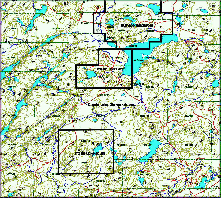
The Prairie Lake south Property consist of 30 contiguous unpatented mining
claims, located approximately 45 kilometers northwest of Marathon
and 24km north of Hwy. 17. The property is readily accessible from Trans-
Canada Highway 17 - Dead Horse Road. The Prairie Lake Road cut the main part of
the Property in the northern section and the southern section of the property is
accessibly true logging Roads.
Claims:
The Prairie Lake south Property consists of 2 unpatented contiguous mining
claims ( 30 units,
480 hectare ) recorded in good standing in Thunder Bay Mining Division within
the Foxtrap
Lake Twp. G-0592 .
Claims/units
4207515 (15 ), 4207516 (15 )
Summary:
We located several new Pegmatite Bodies on the Prairie Lake south property. Several rock sample where taken from these Pegmatite Bodies, we found 6 locations on this property with anomaly values in Uranium Thorium, Rubidium, Tantalum and Niobium.
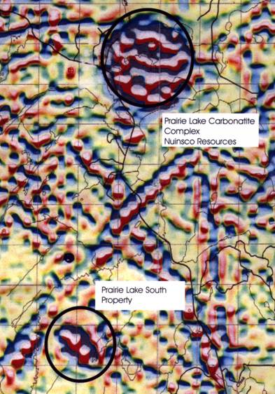
This property lies to the south of Nuinsco Resources Carbonatite Complex.
Scintillometer Reedings and Sample site Numbers
from the Prairie Lake south Property
Sample site:
# 5 700 to 800 C.P.M Setting x 100
# 6 80 to 85 C.P.M Setting x 100
#7 70 C.P.M Setting x 100
#8 15000 C.P.M Setting x 1000
# 9 15000 C.P.M Setting x 1000
# 10 75 to 80 C.P.M Setting x 100
# 11 21000 C.P.M Setting x 1000
Mag map Prairie Claim Map
Lake Complex
Regional Structural Setting Recommendations For
Map & Report Regional Exploration
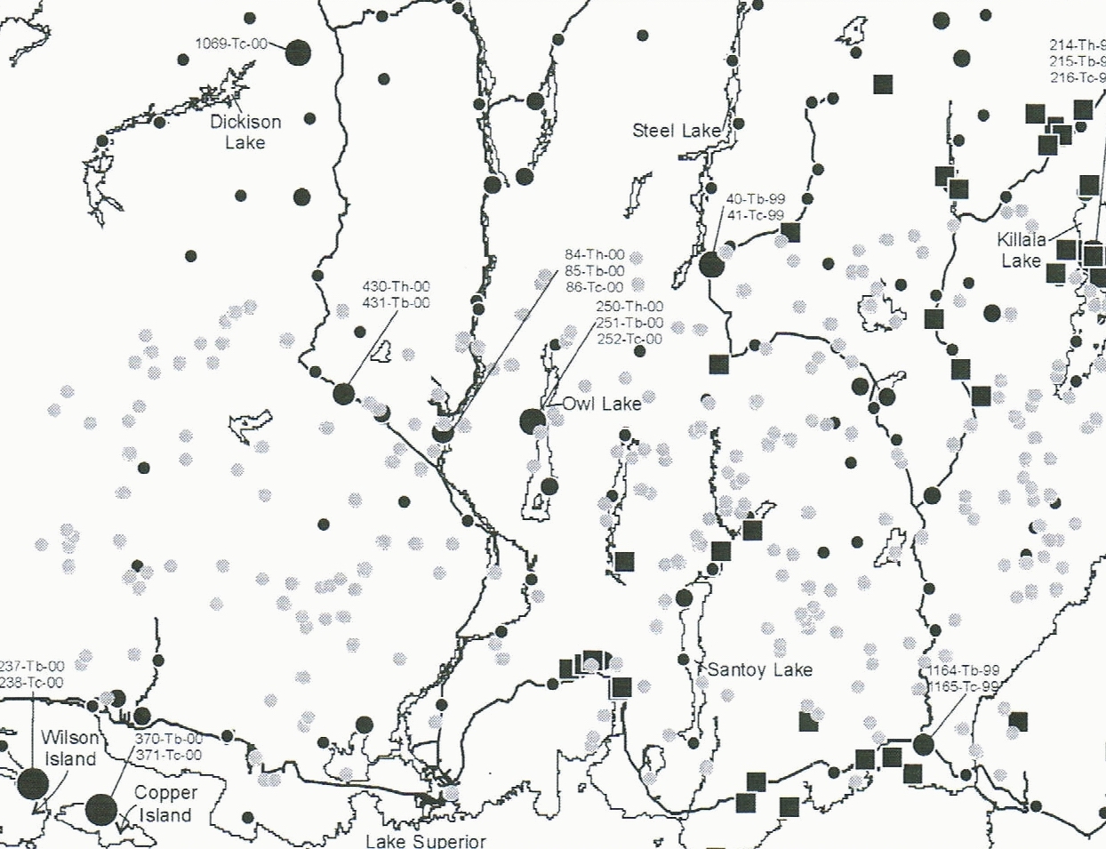
Sample site with anomalous geochemical Kimberlite signatures
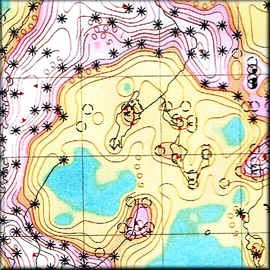
Airborne Magnetic and Electromagnetic Map
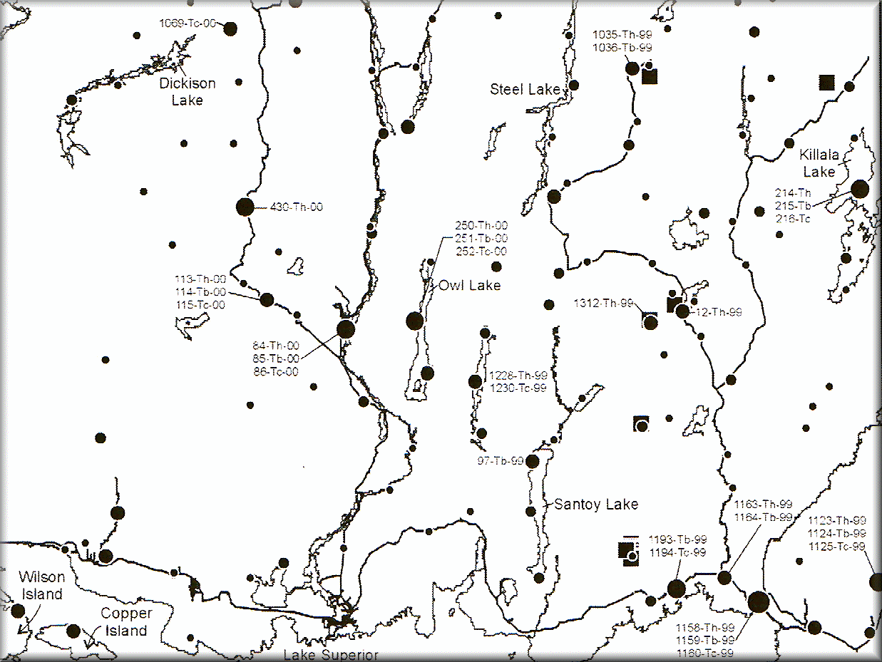
Sample sites with anomalous geochemical rare elements Carbonatite signatures
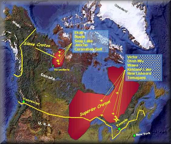
Superior Croton
History
The advent of widespread diamond exploration in Canada is a recent phenomenon
prompted by the discovery of primary diamonds in the Lac de Gras area of the
Northwest Territories in 1991 and the subsequent development of the Ekati and
Diavik Mines. Apart from the claims now held by Ripple Lake Resources there is
only two other active claim blocks in the area. One block of claims located
within the northern portion of the Foxtrap claim block, covers the Prairie Lake
complex, an alkalic-carbonatite complex, which is currently being exploration
for rare earth elements by Nuinsco Resources. The other block lies contiguous to
the west of the Ripple Lake claim group and is been explored for gold and base
metals by Phoenix Matachewan Mines Inc.
The absence of claims suggests that little recent diamond exploration has been done in the area and that diamond exploration data in the area provided by the government has not been followed up. To evaluate the diamond potential of the area the Ontario Geological Survey (“OGS”) conducted a till and alluvium heavy mineral, kimberlite indicator mineral sampling program in the area in 1999. The results of this survey pertinent to the Issuer’s properties are set forth. In conjunction with the kimberlite indicator mineral sampling the OGS also conducted a high resolution helicopter airborne magnetic and electromagnetic geophysical survey in the area. The results of this work outlined a number of like geophysical anomalies similar to the anomalies from known kimberlites on the Prairie Lake south property. Most of the previous historical work in the general area was focused on gold and base metal exploration and is not directly applicable to diamond exploration.
The Ontario Geological Survey carried out a kimberlite indicator mineral sampling program in the Marathon area following the success of a similar sampling program elsewhere. The sampling returned a number of kimberlite indicator minerals and seven areas and six individual anomalies were identified with potential for diamond mineralization. The property is strategically located on the basis of these results. The sampling was limited in scope and of insufficient density to establish the provenance of the indicator mineral anomalies. In addition, not enough is known about the glacial transport history to determine the proximity of the kimberlite source rocks. The Prairie Lake south Property was also covered by a high resolution helicopter airborne magnetic and electromagnetic geophysical survey as part of the Ontario Geological Survey, Treasure Hunt program. This survey outlined a number of circular anomalies which look similar to the signature of kimberlite pipes.
For more Information on this property please contact:
Rudy Wahl
Ph. 807 229 1165
Fax. 807 229 3155
eMail: www.rwahl@renegadeisp.com